| DATE: | 2-27 AUGUST 2012 |
| SITUATION: | KARAKORAM MOUNTAIN RANGE: BALTORO GLACIER (PAKISTAN). |
| TRIP: | Flight: Madrid (Spain), Zurich, Istanbul, Dubai, Islamabad 630 m (Pakistan) |
| ASCENT: | UNIDENTIFIED MOUNTAIN (GPS ELEVATION: 5860 m) (ON THE LEFT BANK OF THE WEST VIGNE GLACIER, AND TO THE EAST OF IHAKORA PEAK) |
| ROUTE, WALKING: | Askole 2995 m, Baltoro glacier, Concordia 4598 m, Unidentified mountain 5860 m, Gondogoro La (pass) 5620 m, Hushe 3185 m |
| HEIGHT DIFFERENCE: | + 2883 m, - 2675 m, walking |
| DISTANCE: | Approx. 144 km |
| TIME TREKKING: | 12 Days (included 1 Rest day) |
| PAKISTAN'S TREKKING AGENCY: | KARAKORAM ADVENTURE HOLIDAYS (ADVENTURE LAND)
Agency manager and mountain guide: Anis Hussain Sardar (porters chief): Zakir Hussain Satpara Cook: Haqan Ali Muhammed Yanyupa Porters: approx. 10 porters, included 1 mule driver with 3 mules; Just 5 porters from Concordia to Hushe |
| PEOPLE: | Raza Meer (Haji), Fida Ali Sultanpa, Bohdan Linda, Jana Kubanova, Lilian Fernandez Gonzalez, Tomas Fernandez-Montesinos, Carlos Penalva |

The Baltoro glacier. Wikipedia.

The KASHMIR REGION (Pakistan, India, China). Encyclopaedia Britannica.
CLICK ON THE + - BUTTONS ON THIS MAP TO ZOOM IN OR OUT.
Clockwise route.
Four of the greatest glaciers of the Karakoram are represented (in white colour) on the map above:
From left to right: the HISPAR, BIAFO, BALTORO, and SIACHEN GLACIERS.
| DAY 1: 2 AUGUST 2012 | Flight: Madrid (Spain), Zurich, Istanbul, Dubai (United Arab Emirates) |
| DAY 2 | Flight: Dubai, Islamabad 630 m (Pakistan) |
| DAY 3 | Flight cancelled from Islamabad to Skardu; Road trip from Islamabad 630 m to Naran |
| DAY 4 | Road trip from Naran to Skardu 2258 m |
| DAY 5 | Briefing day and stay at Skardu |
| DAY 6: 7.8.2012 | Road trip from Skardu 2258 m to Askole 2995 m |
START OF TREK (NEXT 12 DAYS TREKKING):
| DAY 7: 8.8.2012 | Trek Askole 2995 m - Jula |
| DAY 8 | Trek Jula - Paiju |
| DAY 9 | Rest day at Paiju |
| DAY 10 | Trek Paiju - Khoburtse |
| DAY 11 | Trek Khoburtse - Goro 1 |
| DAY 12 | Trek Goro 1 - Concordia 4598 m |
| DAY 13 | Trek Concordia 4598 m - Ali Camp |
| DAY 14: 15.8.2012 | ASCENT OF UNIDENTIFIED MOUNTAIN (GPS ELEVATION: 5860 m) (ON THE LEFT BANK OF THE WEST VIGNE GLACIER, AND TO THE EAST OF IHAKORA PEAK) |
| DAY 15 | Trek Ali Camp - Muneer Camp |
| DAY 16: 17.8.2012 | Trek from Muneer Camp over Gondogoro La 5620 m to Khuspang Camp |
| DAY 17 | Trek Khuspang to Saicho |
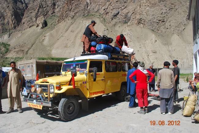
| DAY 18: 19.8.2012 | Trek Saicho to Hushe 3185 m, and drive Hushe to Skardu |
| DAY 19: 20.8.2012 | Stay at Skardu |
| DAY 20 | Flight Skardu to Islamabad cancelled; stay at Skardu |
| DAY 21 | Flight Skardu to Islamabad |
| DAY 22 | Stay at Islamabad |
| DAY 23 | Stay at Islamabad |
| DAY 24 | Stay at Islamabad |
| DAY 25: 26.8.2012 | Flights Islamabad-Dubai and Dubai-Istanbul. Short visit to Istanbul (Turkey) |
| DAY 26: 27.8.2012 | Flights Istanbul (Turkey) to Zurich (Switzerland) and Zurich to Madrid (Spain) |

Islamabad (Pakistan): Faisal Mosque.
Lilian Fernandez and Tomas Fernandez-Montesinos.

Mansehra (Pakistan). On the trip Islamabad-Skardu.
View from the Babusar Pass 4170 m, at the top of the Kaghan Valley,
linking Naran and Chilas (Kashmir region, Pakistan).
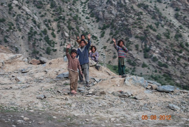
Children waving to us as we drove down the Babusar pass to Chilas (Kashmir region, Pakistan)

Karakoram mountain range (province of Gilgit-Baltistan, Pakistan)
Junction point of the Himalaya, Karakoram and Hindu Kush ranges, where the Gilgit river flows into the Indus river.
Tomas Fernandez-Montesinos.

Karakoram mountain range (province of Gilgit-Baltistan, Pakistan)
Sunset at Skardu.

Karakoram mountain range (province of Gilgit-Baltistan, Pakistan). On the trip from Skardu to Askole.
From left to right: jeep driver, Lilian Fernandez, Bohdan Linda, Jana Kubanova, Tomas Fernandez-Montesinos.
Karakoram mountain range (province of Gilgit-Baltistan, Pakistan)
Drive from Skardu to Askole. Area of Shigar.

Photo by Bohdan Linda
Karakoram mountain range (province of Gilgit-Baltistan, Pakistan)
Young girls going to school in the area of Shigar.

Karakoram mountain range (province of Gilgit-Baltistan, Pakistan)
An ibex at the Askole museum.

Photo by Tomas Fernandez-Montesinos
Karakoram mountain range (province of Gilgit-Baltistan, Pakistan)
First day of trek, from Askole to Jula Camp.

Karakoram mountain range (province of Gilgit-Baltistan, Pakistan)
Crossing a suspension bridge on our first day of trek, Askole-Jula Camp.
Karakoram mountain range (province of Gilgit-Baltistan, Pakistan)
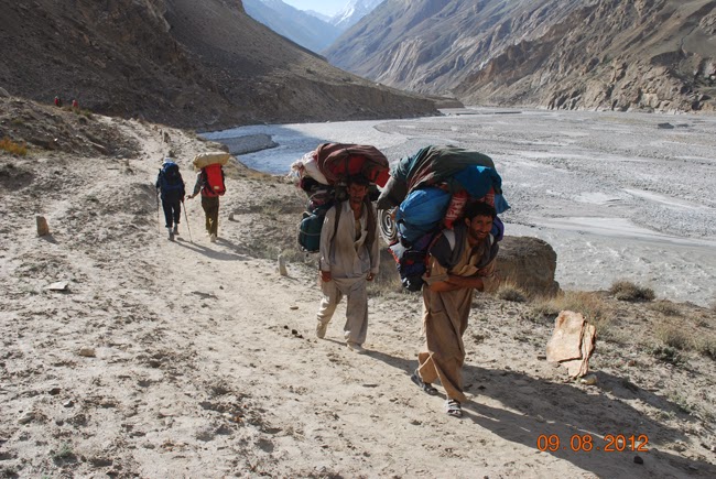
Two Balti porters on the way from Jula to Paiju. Strong men.

Karakoram mountain range (province of Gilgit-Baltistan, Pakistan)
At Paiju Camp. Carlos Penalva (left) and Tomas Fernandez-Montesinos.
Karakoram mountain range (province of Gilgit-Baltistan, Pakistan)
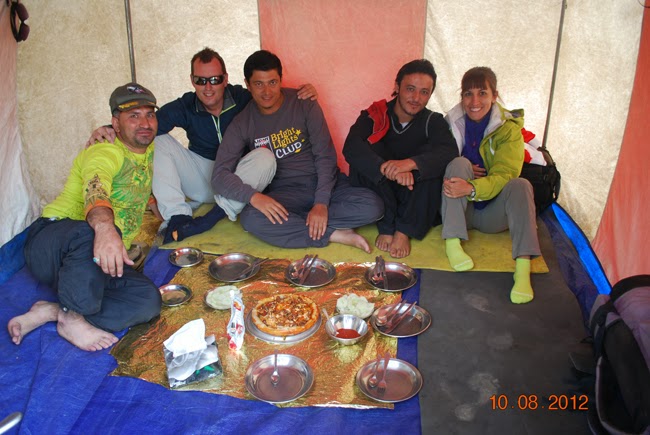
Dinner time at Paiju Camp.
From left to right: Raza Meer, Tomas Fernandez-Montesinos, Fida Ali Sultanpa,
Haqan Ali Muhammed Yanyupa and Lilian Fernandez.
Karakoram mountain range (province of Gilgit-Baltistan, Pakistan)
On the way from Paiju to Khoburtse.

Karakoram mountain range (province of Gilgit-Baltistan, Pakistan)
View of Trango Towers.

Photo by Tomas Fernandez-Montesinos
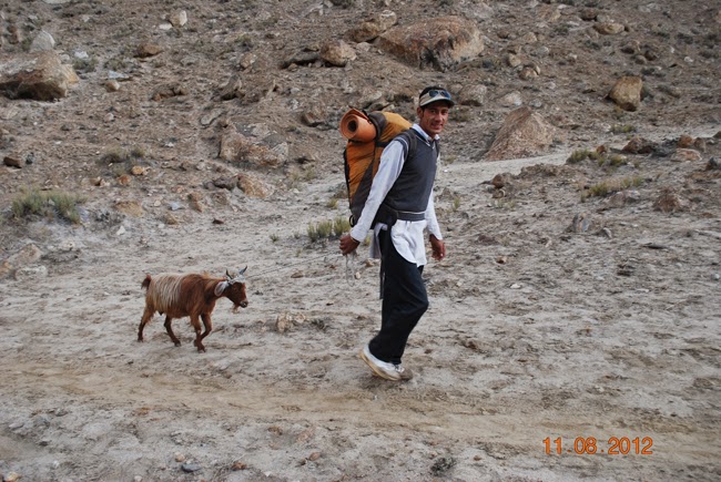
Karakoram mountain range (province of Gilgit-Baltistan, Pakistan)
Two of our porters (left) and our sardar Zakir Hussain Sadpare.
Karakoram mountain range (province of Gilgit-Baltistan, Pakistan). KHOBURTSE CAMP.
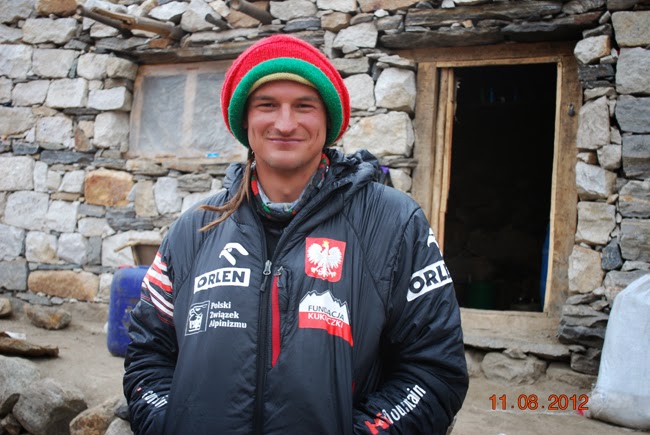
Polish climber ADAM BIELECKI, who summited Mount K2 8611 m on the 31.7.2012 at 10.30 am.
I was lucky to meet this great climber which I didn't know,
and to speak with him and take him a picture.

Karakoram mountain range (province of Gilgit-Baltistan, Pakistan)
Paiju Peak (left) and Uli Biaho (right).

Karakoram mountain range (province of Gilgit-Baltistan, Pakistan)
Lunch time on the Baltoro glacier. Part of our team, great people.

Karakoram mountain range (province of Gilgit-Baltistan, Pakistan)
Lilian Fernandez treating one of our Balti porters at Goro 1 Camp.

Photo by Tomas Fernandez-Montesinos
Karakoram mountain range (province of Gilgit-Baltistan, Pakistan)
Sunset time at Goro 1 Camp.

Karakoram mountain range (province of Gilgit-Baltistan, Pakistan)
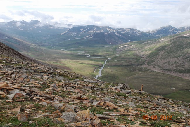
View from Goro 1 Camp.

Karakoram mountain range (province of Gilgit-Baltistan, Pakistan)
Mount Masherbrum (K1) 7821 m, as seen from the area of Goro 1 Camp.

Karakoram mountain range (province of Gilgit-Baltistan, Pakistan)
Muztagh Tower 7273 m.

Karakoram mountain range (province of Gilgit-Baltistan, Pakistan)
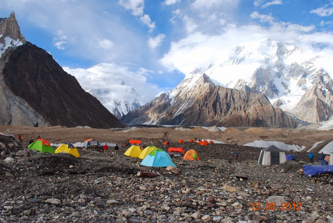
View of the peaks surrounding Concordia Camp.

Karakoram mountain range (province of Gilgit-Baltistan, Pakistan)
Concordia Camp. Left to right: Lilian Fernandez, Anis Hussain, and two of our porters.

Karakoram mountain range (province of Gilgit-Baltistan, Pakistan)
View of Mitre Peak 6010 m at Concordia - Spanish - Camp.

Photo by Tomas Fernandez-Montesinos
Karakoram mountain range (province of Gilgit-Baltistan, Pakistan)
Mitre Peak 6010 m, over Concordia Camp.
Karakoram mountain range (province of Gilgit-Baltistan, Pakistan)
Concordia Camp, with Mount K2 (cloudy, left) and Broad Peak (right).

Karakoram mountain range (province of Gilgit-Baltistan, Pakistan)
View of a cloudy Mount K2 8611 m, very impressive nevertheless.

Photo by Tomas Fernandez-Montesinos
Karakoram mountain range (province of Gilgit-Baltistan, Pakistan)
Another impressive peak around Concordia Camp.

Photo by Bohdan Linda
Karakoram mountain range (province of Gilgit-Baltistan, Pakistan)
View of Broad Peak 8051 m.

Karakoram mountain range (province of Gilgit-Baltistan, Pakistan)
Impressive Mount Gasherbrum 4, 7925 m.

Photo by Tomas Fernandez-Montesinos
Karakoram mountain range (province of Gilgit-Baltistan, Pakistan)
Left to right: Carlos Penalva, Tomas Fernandez-Montesinos, Zakir Hussain Sadpare, unknown person,
Fida Ali Sultanpa, unknown person, Raza Meer, Anis Hussain, unknown person.

Karakoram mountain range (province of Gilgit-Baltistan, Pakistan)
Heading to Ali Camp, along the West Vigne Glacier.

Karakoram mountain range (province of Gilgit-Baltistan, Pakistan)
Ali Camp. Left to right: Raza Meer, Fida Ali Sultanpa
and Hushe Rescue Team (Mountain guide Husayn and two more).
Karakoram mountain range (province of Gilgit-Baltistan, Pakistan)
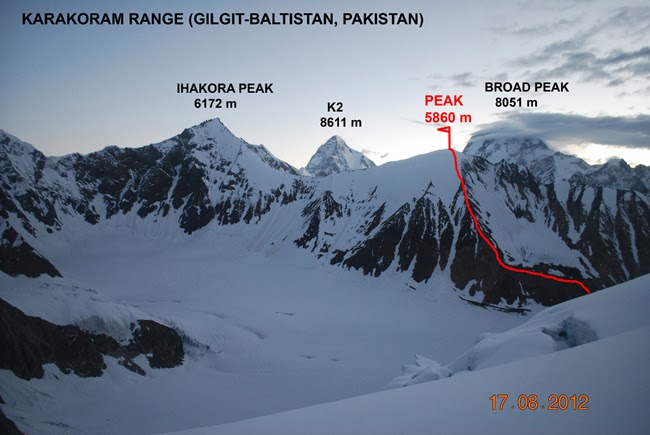
View from the Gondogoro La (pass), with the red route shown
to the unidentified mountain (Peak 5860 m) which we climbed.

Karakoram mountain range (province of Gilgit-Baltistan, Pakistan)
On our way up to an unidentified summit lying on the left bank of the West Vigne Glacier and to the East of Ihakora Peak.
Karakoram mountain range (province of Gilgit-Baltistan, Pakistan)
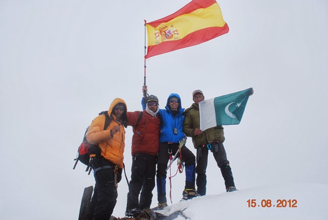
On the summit of an unidentified mountain (GPS elevation was 5860 m), lying on the left bank of the West Vigne Glacier and to the East of Ihakora Peak.
Left to right: Zakir Hussain Sadpare, Raza Meer, Carlos Penalva and mountain guide Husayn

Karakoram mountain range (province of Gilgit-Baltistan, Pakistan)
Muslim prayers at Ali Camp.
Raza Meer, Fida Ali Sultanpa, Husayn and Zakir Hussain Sadpare.

Photo by Bohdan Linda
Karakoram mountain range (province of Gilgit-Baltistan, Pakistan)
Looking downwards from the Gondogoro La.
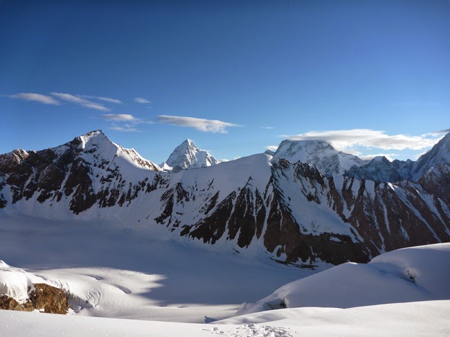
Photo by Bohdan Linda
Karakoram mountain range (province of Gilgit-Baltistan, Pakistan)
View from the top of Gondogoro La (pass): K2 (center) and Broad Peak (right).

Photo by Tomas Fernandez-Montesinos
Karakoram mountain range (province of Gilgit-Baltistan, Pakistan)
Carlos Penalva and Tomas Fernandez-Montesinos at the top of Gondogoro La (pass), GPS elevation 5620 m.

Karakoram mountain range (province of Gilgit-Baltistan, Pakistan)
View of Mount K2 8611 m as seen from the Gondogoro La (pass).
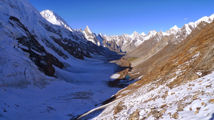
Photo by Tomas Fernandez-Montesinos
Karakoram mountain range (province of Gilgit-Baltistan, Pakistan)
View from the Gondogoro La, looking South.

Photo by Bohdan Linda
Karakoram mountain range (province of Gilgit-Baltistan, Pakistan)
Descending from the Godogoro La (pass).

Karakoram mountain range (province of Gilgit-Baltistan, Pakistan)
Laila Peak 6096 m.

Photo by Tomas Fernandez-Montesinos
Karakoram mountain range (province of Gilgit-Baltistan, Pakistan)
View of the southern slope of the Gondogoro La.
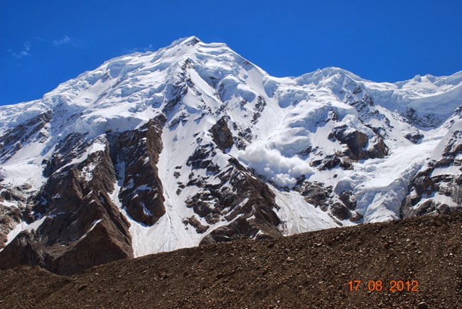
Karakoram mountain range (province of Gilgit-Baltistan, Pakistan)
An avalanche falling down a mountain lying on the southeastern flank of the Gondogoro glacier.

Photo by Bohdan Linda
Karakoram mountain range (province of Gilgit-Baltistan, Pakistan)
Mountains and glacier on the northwestern flank of the Gondogoro glacier.

Photo by Tomas Fernandez-Montesinos
Karakoram mountain range (province of Gilgit-Baltistan, Pakistan)
View of the Gondogoro glacier and its northwestern flank.

Karakoram mountain range (province of Gilgit-Baltistan, Pakistan)
View of the Gondogoro glacier's northwestern flank.

Karakoram mountain range (province of Gilgit-Baltistan, Pakistan)
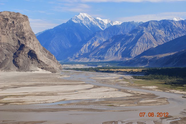
Hushe Valley, with Mount Masherbrum (K1) 7821 m on the background left.

Karakoram mountain range (province of Gilgit-Baltistan, Pakistan)
At Hushe, with Sebastian Alvaro (second left, Spanish TV Documentaries director),
and with two doctors (ophthalmologists working for the Sarabastall NGO and Hushe project),
who treated my eyes. Thank you !
Karakoram mountain range (province of Gilgit-Baltistan, Pakistan)
Leaving Hushe.

Karakoram mountain range (province of Gilgit-Baltistan, Pakistan)
Approaching the village of Kande in the Hushe Valley.

Karakoram mountain range (province of Gilgit-Baltistan, Pakistan)
Children in the village of Kande.

Istanbul (Turkey). Hagia Sophia (Sancta Sophia), 532-537. RETURN TRIP TO SPAIN.
Photo by Tomas Fernandez-Montesinos. Leica camera.
| COSTS (EUROS/PERSON) (FOR CARLOS PENALVA) 2-27 AUGUST 2012 | |
| FLIGHT: | 1038,60 Euros/Person |
| PAKISTAN'S TREKKING AGENCY: | 1325 Euros/Person |
| OTHER COSTS: | 268,66 Euros/Person (Bank charges in Spain for transfer, Pakistan's entry visa, Mountaineering insurance, Medicines, and other expenses in Pakistan, etc) |
| TIPS TO PORTERS, COOK, SARDAR, AND DRIVERS: | 152 Euros/Person |
| MOBILE PHONE CALLS: | 154,03 Euros/Carlos Penalva !!! |
| TOTAL: | 2938,29 Euros/Person |
| TOTAL NUMBER OF DAYS (MADRID-KARAKORAM-MADRID): | 26 Days |
| COST PER DAY AND PERSON: | 113,01 Euros per day and person |
https://carlospenalva.weebly.com/
| DATE: | 28 JULY - 17 AUGUST 2011 |
| SITUATION: | VALAIS ALPS (SWITZERLAND) |
| ROAD TRIP: | 28.7.2011: Madrid (Spain), Guadalajara, Zaragoza, Barcelona, Blanes.
29.7.2011: Blanes, Gerona, La Junquera, Perpignan (France), Narbonne, Montpellier, Orange, Valence, Grenoble, Chambéry, Annecy, Chamonix, Les Praz de Chamonix. 2.8.2011: Les Praz de Chamonix (France), Martigny (Switzerland), Visp, Saas Grund |
| ASCENTS: | ALPHUBEL 4206 m NADELHORN 4327 m* (Cross Peak) * There is a rocky peak within 10 m or so off the Cross peak of the Nadelhorn, which appears to be 40 or 50 centimetres higher. We didn't reach this rocky peak. Both peaks are separated by a gap in a ridge. |
| PEOPLE: | Yolanda Garcia, Carlos Penalva |
31.7.2011. Route, walking: Les Praz de Chamonix, Montenvers 1913 m, Mer de Glace (glacier), Les Praz. (Mont Blanc Massif, Alps, France)

AIGUILLE DU DRU: Petit Dru 3730 m and Grand Dru 3754 m. (Mont Blanc Massif).
VALAIS ALPS:
ALPHUBEL ROUTE NADELHORN ROUTE
CLICK ON THE + - BUTTONS ON THIS MAP TO ZOOM IN OR OUT.
3 - 4 AUGUST 2011. MT. ALPHUBEL 4206 m:
| ASCENT: | ALPHUBEL 4206 m (Valais Alps, Switzerland) |
| ROUTE: | Normal route (Tasch 1440 m, Tasch Hut, Alphubel glacier, Alphubeljoch, Southeast ridge, Alphubel). ROUTE DISPLAYED ON FOLLOWING MAP. |
| HEIGHT DIFFERENCE: | +2766 m, walking |
| DISTANCE (go and return): | Approx. 28 km |
| TIME (from the start to the summit): | 3 August: 3 h, 15 min 4 August: 5 h, 5 min (including stops) |
| TIME (from the summit to the start): | 4 August: 6 h, 50 min (including stops) |
| PEOPLE: | Plamen Todorov (from Bulgary), Carlos Penalva |

Valais Alps (Switzerland).
Tasch Hut 2701 m.

Valais Alps (Switzerland).
Edelweiss flowers near the Tasch Hut.

Valais Alps (Switzerland).
On the way to Mount Alphubel, 4:35 am.

Valais Alps (Switzerland).
Sunrise on the MONTE ROSA 4634 m.

Valais Alps (Switzerland).
Arriving at the Alphubeljoch (Alphubel Pass) 3773 m.

Valais Alps (Switzerland).
A roped team approaching the Alphubeljoch.
On the background, left to right: BREITHORN 4164 m, MATTERHORN 4478 m.

Valais Alps (Switzerland).
Southeast ridge to Mount Alphubel (normal route).

Valais Alps (Switzerland).
Southeast ridge to Mount Alphubel (normal route).

Valais Alps (Switzerland).
Left to right: ALLALINHORN 4027 m, STRAHLHORN 4190 m, RIMPFISCHHORN 4199 m.

Valais Alps (Switzerland).
STRAHLHORN 4190 m, RIMPFISCHHORN 4199 m.

Valais Alps (Switzerland).
Plamen Todorov on the steepest section of Alphubel.

Valais Alps (Switzerland).
View of the Alphubel's summit 4206 m.

Valais Alps (Switzerland).
Mount Alphubel's summit 4206 m. Plamen Todorov, from Bulgary.

Valais Alps (Switzerland).
Carlos Penalva on the summit of Mount Alphubel 4206 m, 9:10 am.

Valais Alps (Switzerland).
View from the Alphubel, left to right: TASCHHORN 4491 m and DOM 4545 m.

Valais Alps (Switzerland).
Left to right: FLETSCHHORN 3993 m, LAGGINHORN 4010 m and WEISSMIES 4017 m

Valais Alps (Switzerland).
MONTE ROSA 4634 m and LISKAMM 4527 m.

Valais Alps (Switzerland).
BREITHORN 4164 m, on the centre right.

Valais Alps (Switzerland).
View of the MATTERHORN 4478 m.

Valais Alps (Switzerland).
WEISSHORN 4506 m.
8 - 9 AUGUST 2011. MT. NADELHORN 4327 m:
| ASCENT: | NADELHORN 4327 m (Valais Alps, Switzerland) |
| ROUTE: | Normal route (Saas Grund 1580 m, Saas Fee, Mischabel Hut, Hohbalm glacier, Windjoch, Northeast ridge, Nadelhorn). ROUTE DISPLAYED ON PREVIOUS MAP. |
| HEIGHT DIFFERENCE: | +2747 m, walking |
| DISTANCE: | Approx. 19 km (go and return) |
| TIME (from the start to the summit): | 8 August: 4 h, 40 min 9 August: 3 h, 40 min (including stops) |
| TIME (from the summit to the start): | 9 August: 8 h, 25 min (including stops) |
| PEOPLE: | Christophe Hugot (from France), Carlos Penalva |

Valais Alps (Switzerland).
On the rocky way to the Mischabel Hut. Nadelhorn.

Valais Alps (Switzerland).
Mischabel Hut 3335 m, on the route to Mt. Nadelhorn.

Valais Alps (Switzerland).
Francesco and Valentina (from Italy) traversing the Hohbalm glacier, 5:40 am.

Valais Alps (Switzerland).
Nadelhorn 4327 m.

Valais Alps (Switzerland).
Ascending the Northeast ridge of Nadelhorn 4327 m (normal route).

Valais Alps (Switzerland).
The Northeast ridge of Nadelhorn 4327 m (normal route).

Valais Alps (Switzerland).
Nadelhorn 4327 m. Christophe Hugot, from France.

Valais Alps (Switzerland).
Final slopes to the Nadelhorn 4327 m.

Valais Alps (Switzerland).
Francesco and Valentina (from Italy) on the summit of Nadelhorn 4327 m.

Valais Alps (Switzerland).
Carlos Penalva on the summit of Nadelhorn 4327 m, 8:05 am.

Valais Alps (Switzerland).
View of the DOM 4545 m.

Valais Alps (Switzerland).
Descending from the Nadelhorn 4327 m.

Valais Alps (Switzerland).
LENZSPITZE 4294 m.

Valais Alps (Switzerland).
Descending from the Mischabel Hut, towards Saas Fee.
10 - 11 AUGUST 2011. BERN (SWITZERLAND).

Bern (Switzerland). The Clock Tower (der Zeitglockenturm).
12 AUGUST 2011. LUCERNE (SWITZERLAND).

Lungerer lake (Obwalden, Switzerland).

Lucerne (Switzerland). Yolanda Garcia on the edge of Lake Lucerne (Vierwaldstattersee).
| A BIT OF HISTORY OF SWITZERLAND: |
| It was on the eastern shore of Lake Lucerne, on the Rutli Meadow, where the early Swiss Confederation was born on August 1291, when the people from the valleys of URI, SCHWYZ, and UNTERWALDEN agreed upon their mutual support and help in case of need (war, attacks, an outside governor, etc), and to defend their rights and liberties. This alliance was established in the Rutli Oath. |

Lucerne (Switzerland).

Lucerne (Switzerland). The Lion Monument (Lowendenkmal).
| The LION MONUMENT (Lowendenkmal) commemorates the Swiss Guards (around 600) who were massacred on August 1792 during the French Revolution, when revolutionaries stormed the Tuileries Palace in Paris (France), where the king Louis XVI was. The king fled but was later arrested, and finally executed on January 1793. |
RETURN TRIP BY CAR:
15.8.2011: Tenero (Switzerland), Locarno, Verbania (Italy), Genoa area, Spotorno.
16.8.2011: Spotorno, Ventimiglia, Nice (France), Cannes, Aix-En-Provence, Arles, Nimes, Montpellier, Perpignan, La Junquera (Spain), Figueras, Rosas.
17.8.2011: Rosas, Figueras, Gerona, Barcelona, Lerida, Zaragoza, Guadalajara, Madrid (Spain).
| COSTS (EUROS/PERSON) (FOR CARLOS PENALVA) | |
| TOTAL COSTS: | 1132,42 Euros/Person |
| TOTAL NUMBER OF DAYS (MADRID-ALPS-MADRID): | 21 Days |
| COST PER DAY AND PERSON: | 53,92 Euros per day and person |
https://carlospenalva.weebly.com/
| DATE: | 8-20 JULY 2009 |
| SITUATION: | VALAIS ALPS (SWITZERLAND) |
| ROAD TRIP: | Madrid (Spain), Zaragoza, Barcelona, Narbonne (France), Nimes, Valence, Grenoble, Chamonix, Martigny (Switzerland), Visp, Saas Grund, Tasch. |
| ASCENTS: | MOUNT LAGGINHORN 4010 m, 12.07.2009
Route: Saas Grund 1559 m, Kreuzboden, Hohsaas, Mount Lagginhorn summit 4010 m. DUFOURSPITZE (MONTE ROSA) 4634 m, 16.07.2009 Route: Rotenboden Railway Station 2815 m, Gorner Glacier 2515 m, Old Monte Rosa Hut 2795 m, Monte Rosa Glacier, Sattel 4.359 m, Dufourspitze summit 4.634 m (Monte Rosa) |
| PEOPLE: | Yolanda Garcia, David Sanchez Fernandez, Javier Vera, David de Paz, Anton Padin, Carlos Penalva |

Situation map. Valais Alps (Switzerland)
MOUNT LAGGINHORN 4010 m:

Situation map. Valais Alps (Switzerland): Mount Lagginhorn

Valais Alps (Switzerland). Taeschhorn and Dom in the background

Valais Alps (Switzerland). Camp under Mount Weissmies
Left to right: Javier Vera, Anton Padin, David Sanchez and Carlos Penalva.

Valais Alps (Switzerland). Mount Lagginhorn

Valais Alps (Switzerland). Arriving at Mount Lagginhorn's summit

Valais Alps (Switzerland). Mount Lagginhorn's summit 4010 m
Left to right: Carlos Penalva and David Sanchez.

Valais Alps (Switzerland). View from Mount Lagginhorn's summit. Mount Weissmies on the right

Valais Alps (Switzerland). Mount Lagginhorn
DUFOURSPITZE (MONTE ROSA) 4634 m:

Situation map. Valais Alps (Switzerland): the Monte Rosa massif

Valais Alps (Switzerland). Monte Rosa and Mount Liskamm

Valais Alps (Switzerland). Monte Rosa and its Dufour Peak

Valais Alps (Switzerland). The Monte Rosa

Valais Alps (Switzerland). Gorner glacier

Valais Alps (Switzerland). Old Monte Rosa hut 2795 m

Valais Alps (Switzerland). Mount Liskamm 4527 m

Valais Alps (Switzerland). Gorner Glacier and the Matterhorn

Valais Alps (Switzerland). Ascending the Dufourspitze (Monte Rosa), with the Matterhorn in the background

Valais Alps (Switzerland). Ascending the Dufourspitze (Monte Rosa)

Valais Alps (Switzerland). Arriving at the Dufourspitze's summit (Monte Rosa)

Valais Alps (Switzerland). View from the Dufourspitze: the Matterhorn and the Dent Blanche

Valais Alps (Switzerland). View from the Dufourspitze: the Weisshorn on the right

Valais Alps (Switzerland). View from the Dufourspitze: the Nordend Peak of the Monte Rosa

Valais Alps (Switzerland). Dufourspitze's summit 4634 m (Monte Rosa)

Valais Alps (Switzerland). Dufourspitze's summit 4634 m (Monte Rosa)
Left to right: Carlos Penalva, David de Paz and Anton Padin

Valais Alps (Switzerland). Dufourspitze's summit 4634 m (Monte Rosa)
David Sanchez, David de Paz and Anton Padin

Valais Alps (Switzerland). Dufourspitze's summit 4634 m (Monte Rosa)
Javier Vera and Carlos Penalva

Valais Alps (Switzerland). Mount Liskamm as seen from the Dufourspitze
Valais Alps (Switzerland). View from the Dufourspitze

Valais Alps (Switzerland). Yolanda Garcia on the Gornergrat
In the background: Monte Rosa (left), Mount Liskamm (centre), and Gorner glacier

Valais Alps (Switzerland). Zermatt

Valais Alps (Switzerland). Zermatt.
First mountaineers to climb the Matterhorn 4478 m, on the 13-14th July 1865.
| COSTS (EUROS/PERSON) (FOR CARLOS PENALVA) | |
| TOTAL COSTS: | 662,35 Euros/Person |
| TOTAL NUMBER OF DAYS (Madrid-Alps-Madrid): | 13 Days |
| COST PER DAY AND PERSON: | 50,95 Euros per day and person |
https://carlospenalva.weebly.com/
| DATE: | 7-19 JULY 2007 |
| SITUATION: | ALPS: MONT BLANC MASSIF, ECRINS MASSIF. (FRANCE) |
| ROAD TRIP: | Madrid (Spain), Zaragoza, Barcelona, Narbonne (France), Nimes, Orange, Valence, Grenoble, Albertville, Chamonix, Les Praz de Chamonix |
| ASCENTS: | MOUNT BREVENT 2525 m (MT BLANC MASSIF), 10.07.2007 MONT BLANC 4810 m, 15.07.2007 Route, walking: Les Houches 995 m, Col du Mont Lachat 2077 m, Nid d'Aigle 2372 m, Rognes Hut 2768 m, Aiguille du Gouter (Hut) 3863 m, Dome du Gouter, Mont Blanc's summit MOUNT TETE DE LA MAYE 2518 m (ECRINS MASSIF), 17.07.2007 |
| PEOPLE: | Armando Marin, Andres Vilchez, Carlos Penalva |
MASSIF DU MONT BLANC (ALPS, FRANCE):
SATURDAY 7.7.2007:
We leave Madrid at 1.15 pm.
Road trip: Madrid, Guadalajara; paramos a comer en Medinaceli
estacion; Zaragoza, Fraga, Lerida, Tarrega, Cervera, Igualada,
Martorell, Barcelona, Gerona, Figueras; al llegar a la Junquera
ya de noche, paramos a cenar. Pasamos a Francia y dormimos en
mitad del campo en las cercanias de Ceret.
SUNDAY 8.7.2007:
He pasado mala noche, devolviendo la escalibada que cene en La Junquera.
Road trip:
Ceret (Francia), Perpignan, Narbonne, Beziers, Montpellier,
Nimes, Orange, Montelimar, Valence sur le Rhone, Grenoble sur L'Isere,
Albertville, Ugine, Megeve, Saint Gervais, Chamonix,
les Praz de Chamonix. Llegamos a Les Praz a las 2.30 pm, es decir 25
h y 15 min despues de salir de Madrid, y tras 1460 km de viaje.
Como otros anyos nos instalamos en el Camping "La Mer de Glace"
en Les Praz de Chamonix.
Aqui sigue Alexis Lachenal de encargado, jefe, y duenyo,
(como otros anyos) muy amable y hablando espanyol.
Alexis es nieto de Louis Lachenal, primer montanyero en
ascender un ochomil, el Annapurna, junto con Maurice Herzog en 1950.
Por la tarde llueve.
Alps: Mont Blanc massif. Camping La Mer de Glace, Les Praz de Chamonix.
MONDAY 9.7.2007:
Ha estado lloviendo buena parte de la noche, tronando ademas.
El dia amanece cubierto, y nos vamos a Chamonix a ver tiendas.
Sigue lloviendo de forma intermitente, y nevando por encima de
2500 m segun anuncia la Meteo y segun constatamos cuando se
abren claros. Mas agua en la tarde noche y temperatura baja.
Tenemos que esperar para subir para arriba y empezar a aclimatar.

Chamonix-Mont Blanc.

Chamonix-Mont Blanc. Monument a Jacques Balmat et a Horace-Benedict de Saussure.
TUESDAY 10.7.2007: MOUNT BREVENT'S SUMMIT 2525 m.
Hoy he subido al Mt Brevent 2525 m, andando desde Bossons 1000 m.
Recorrido: Bossons, Refugio de Bel Lachat 2152 m, Cumbre del Mt Brevent 2525 m
Por encima de 1900 m ha estado nevando. Arriba en la cumbre, niebla.
Descenso andando a Chamonix.
Temperatura por la tarde-noche en el camping a 1065 m: 10 grados.

Alps Mont Blanc massif. Les Praz de Chamonix.

Chamonix-Mont Blanc.
Alps Mont Blanc massif. Mount Brevent 2525 m

Alps Mont Blanc massif. Mount Brevent 2525 m

Alps Mont Blanc massif. Mount Brevent 2525 m
WEDNESDAY 11.7.2007: MER DE GLACE GLACIER.
Subimos andando desde el camping en Les Praz de Chamonix 1065 m
hasta el glaciar de La Mer de Glace (el mar de hielo).
En este glaciar llegamos hasta 1973 m de altitud, un poco antes
de la confluencia del glaciar de Leschaux con la Mer de Glace.
Descendemos hasta Les Praz por el mismo itinerario que a la subida.
Tiempo nublado pero sin lluvia.
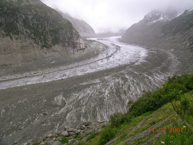
Alps Mont Blanc massif. La Mer de Glace glacier.
La Mer de Glace.

La Mer de Glace glacier.
THURSDAY 12.7.2007: REST DAY IN CHAMONIX.
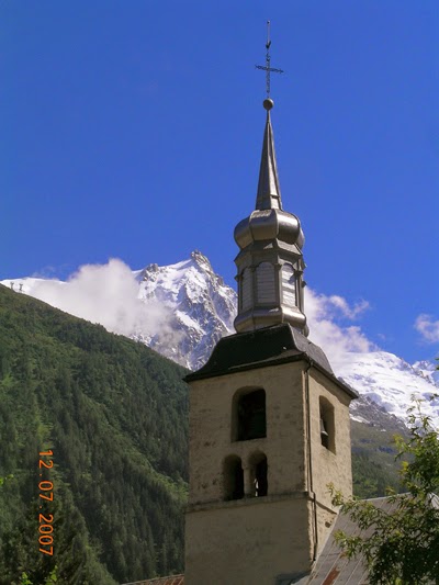
The church of Chamonix.
FRIDAY 13.7.2007: WE START THE MONT BLANC ASCENT.

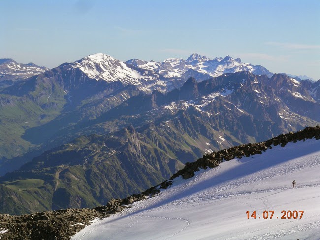
The Mont Blanc 4810 m, as seen from Chamonix.
View of the normal route to the summit.
Rognes Hut 2768 m, on the route to the Mont Blanc.

The Aiguille Verte 4122 m (left), and the Aiguille du Midi 3842 m (right).

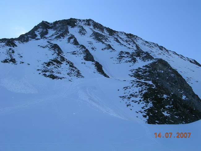
Aiguille du Gouter 3863 m, and Aiguille de Bionnassay 4052 m.
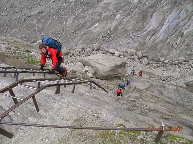
SATURDAY 14.7.2007: AIGUILLE DU GOUTER'S CLIMB 3863 m, ON THE NORMAL ROUTE TO MONT BLANC.
Aiguilles Rouges Massif, and the Mont Buet.
Aiguille du Gouter.

Aiguille du Gouter.
Aiguille du Gouter.
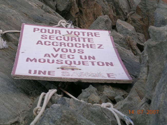
Corridor on the Aiguille du Gouter, with danger of falling stones.
AIGUILLE DU GOUTER: LE BOULODROME

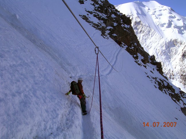
Andres Vilchez climbing along the Aiguille du Gouter, on the route to the Mont Blanc.

Climbing along the Aiguille du Gouter,
the hardest section on the normal route to the Mont Blanc.

Aiguille du Gouter´s hut.
SUNDAY 15.7.2007: MONT BLANC'S SUMMIT. AU SOMMET DU MONT BLANC.
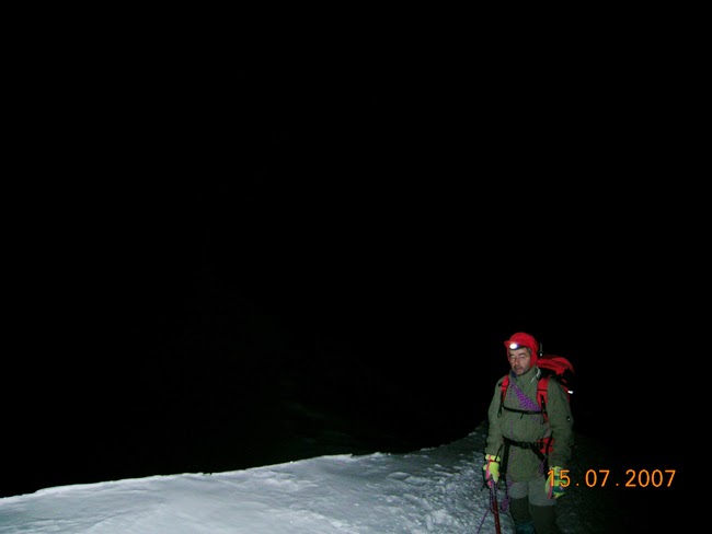
Summit's day.

Carlos Penalva inside the Vallot Vivac 4362 m, 3.30 am.

Daybreak on the Bosses Ridge, approx. 4540 m.

Andres Vilchez a few steps under the Mont Blanc's summit.

Andres Vilchez (left) and Carlos Penalva (right) on top of Mont Blanc 4810 m, 15.7.2007, 6.10 am.

View from the Mont Blanc towards the Fourthousanders route.

View from the summit of Mont Blanc.

The Valley of Chamonix as seen from the summit of Mont Blanc.

Aiguille de Bionnassay 4052 m.

Descending from Mont Blanc.
MASSIF DES ECRINS (ALPS, FRANCE):
MONDAY 16.7.2007: TRIP TO THE ECRINS MASSIF.

La Berarde (Alps, Ecrins Massif, France).
Armando Marin and Andres Vilchez.
TUESDAY 17.7.2007: TETE DE LA MAYE'S ASCENT 2518 m.

Barre des Ecrins 4102 m (Alps, Ecrins Massif).
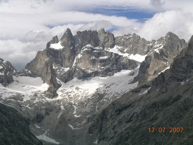
Pic de la Meije 3983 m (Alps, Ecrins Massif, France).
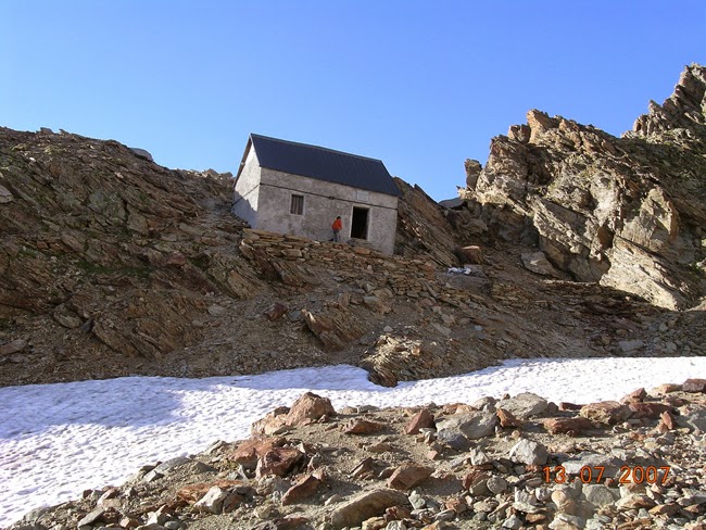
WEDNESDAY 18.7.2007: PILATTE HUT.

Pilatte Hut 2580 m (Ecrins Massif).
| COSTS (EUROS/PERSON) (FOR CARLOS PENALVA) | |
| TOTAL COSTS: | 688,65 Euros/Person |
| TOTAL NUMBER OF DAYS (MADRID-ALPS-MADRID): | 13 Days |
| COST PER DAY AND PERSON: | 52,97 Euros per day and person |
https://carlospenalva.weebly.com/
